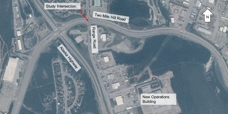
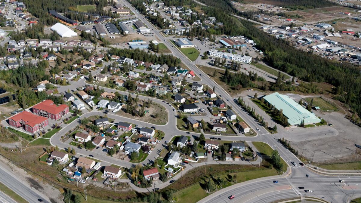
Above: Aerial photo of Range Road corridor with the Range Road & Two Mile Hill Road intersection on the bottom right (Photo: Alistair Maitland Photography 2018)

McIntyre Drive
June 2, 2022
Range Road and Two Mile Hill Road
June 2, 2022Project Status/Updates
Status: Recently Completed
Updates
- June 28, 2021
- Project website updated.
- December 3, 2020
- The Community Survey results will be analyzed and considered in the draft recommended conceptual plan.
- The project is anticipated to be completed early in 2021.
- Watch this five minute video as a summary to the Range Rd Corridor Study(produced mid-November 2020)
- November 24, 2021
- The City held a webinar on Tuesday November 24th, 2020. The full webinar was recorded and can be found here.
- November 18, 2020
- In October, the City held a series of stakeholder workshops to gather input on the issues and priorities for the corridor. We heard from a variety of voices including Takhini residents, recreation/sports groups, employers along the corridor and City departments. This input was considered by the City in addition to technical information.
- Two draft design concepts have been developed for the Range Road corridor. The links below will download a PDF of the corridor cross-sections and detailed recommended improvements superimposed on an aerial photo of the corridor.
- Cross-section for both Options 1 and 2.
- Conceptual design for Option 1
- Conceptual design for Option 2
- Over the next several weeks the City will review and refine the designs described above before selecting a preferred design in mid-December.
Documents
Range Road Corridor Study – Conceptual Design Report (Final; March 8, 2021)
Range Road Corridor – Webinar (November 24, 2020)
Range Road Corridor Conceptual Design – Cross Section for Both Options (Draft; November 16, 2020)
Range Road Corridor Conceptual Design – Option 1 – Bi-directional Bike Lane (Draft; November 16, 2020)
Range Road Corridor Conceptual Design – Option 2 – Uni-directional Bike Lane (Draft; November 16, 2020)
Range Road Corridor – Video Summary (November 18, 2020)
Background
The City is conducting a study to develop a conceptual design for the Range Road Corridor between Mountain View Drive and Two Mile Hill Road. The conceptual design will be for a multi-modal corridor designed for all ages, abilities, and modes of travel. The conceptual design study looked at opportunities to improve conditions for walking, cycling and transit along the corridor, while accommodating vehicle movements and traffic operations. This project is intended to complement and integrate with the intersection improvements at Range Road and Two Mile Hill Road, which looked at assessing improvements to the intersection for all modes. Improvements at this intersection are also considering options to improve walking and cycling, in addition to transit and driving, to make the intersection easier and safer.
Range Road, between Mountain View Drive and Two Mile Hill Road, is a two-lane neighbourhood collector with northbound transit, curbside parking and sidewalks on both sides, and unmarked on-street cycling. Traffic volumes are approximately 6,000 vehicles per day. Range Road bisects the neighbourhoods of Takhini North and West from Takhini East. Major destinations on/adjacent to Range Road include private residences, Yukon University, Takhini Elementary School, Pepsi Softball Complex, Broomball, Takhini Arena, Government of Yukon offices, Fisheries and Oceans Canada, and two new multi-family complexes currently under construction.
Through the recent Official Community Plan (OCP) process, the Takhini neighbourhood has expressed an interest for traffic calming of Range Road, with vehicle speeding being an ongoing concern both with residents and the Takhini School. Transit has proposed increased routes on Range Road, with buses in both directions and Yukon University becoming a primary transit hub.
In 2018, the City of Whitehorse prepared a Bicycle Network Plan, outlining a long-term vision for cycling in Whitehorse. Through the creation of the Bicycle Network Plan, Range Road was identified as a future separated bicycle path for all ages and abilities (AAA). Facilities for walking and cycling will connect with multi-use trails along Range Road south (Airport Trail), Two Mile Hill and Range Road North.
The draft Trail plan (map in Appendix C) identifies existing and proposed trails for motorized and non-motorized users throughout Takhini neighbourhood.
Links
Related Projects
Range Road Asphalt Path Extension
Range Road and Two Mile Hill Road
Relevant Plans and Studies
2010 Official Community Plan
Bicycle Network Plan (2018)
Schools Mobility Review (2018)
Transit Master Plan (2018)
Transportation Demand Management Plan (2014)
Trail Plan (2020)

